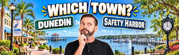

Safety Harbor vs. Dunedin: Which Northern Pinellas Town Has Better Walkability? (2026 Guide)
If you are looking for an authentic, walkable downtown in West Central Florida that isn’t dominated by high-rise condo towers or commercial strip malls, your search almost certainly points to two northern Pinellas County enclaves: Dunedin and Safety Harbor.
Separated by just eight miles across the peninsula, both cities offer historic brick-paved streets, locally owned restaurants, waterfront parks, and vibrant weekend events. However, their physical layouts and daily pedestrian rhythms are completely different.
Choosing between them comes down to one fundamental lifestyle choice: Do you want a dense, active, golf-cart-friendly downtown grid built around a 47-mile multi-use trail? Or do you want a calm, shaded, linear Main Street anchor leading directly to an Old Tampa Bay pier?
Below is the definitive ground-level walkability comparison, alternative transit breakdown, daily errand logistics, and comparison matrix for 2026.
Quick Walkaway: The Walkability Matcher
-
Dunedin (Walk Score: 85–88 | "Very Walkable"): Dense multi-block grid, Fred Marquis Pinellas Trail running directly through Main Street, 9+ craft breweries within a 5-minute walk, and a registered municipal golf cart program ($10/yr).
-
Safety Harbor (Walk Score: 72–75 | "Somewhat Walkable"): Linear east-west Main Street axis ending at the historic Safety Harbor Resort & Spa, Old Tampa Bay Pier, shaded oak canopy, and a quiet morning-first wellness vibe.
-
The Core Difference: Dunedin’s walkability extends across a wider multi-street grid with higher commercial energy. Safety Harbor’s walkability concentrates along a relaxed 6-block stretch of Main Street before giving way to quiet residential neighborhoods.
1. Downtown Grid & Footprint: Grid vs. Linear Spine
How far you can walk—and what you pass along the way—differs significantly depending on which city grid you choose.
[Dunedin Grid]        ──► Pinellas Trail Spine + Main St + Douglas Ave ──► Multi-Directional Exploration
[Safety Harbor Spine] ──► Main Street Axis (9th Ave to Bayshore Blvd)  ──► Linear Point-A to Point-B Walk
Dunedin: The Multi-Block Urban Grid
Downtown Dunedin operates as a true commercial grid bounded by Skinner Boulevard to the north, Union Street to the south, and Douglas Avenue to the east.
Because the Pinellas Trail acts as a pedestrian "highway" bisecting Main Street, foot and bicycle traffic flow seamlessly in all four cardinal directions. You can step out of a condo or historic cottage on Douglas Ave, walk two blocks west to Edgewater Park and Marina, hit three craft breweries (like 7venth Sun or Dunedin Brewery), and grab dinner along Broadway without ever stepping near a busy arterial road.
-
Street Level Feel: High energy, highly social, continuous sidewalk outdoor dining, and active street corners past 9:00 PM.
Safety Harbor: The Linear Canopy Avenue
Downtown Safety Harbor is organized along a clean, linear east-west spine: Main Street. Stretching roughly 6 blocks from 9th Avenue down to Bayshore Boulevard and the Old Tampa Bay Pier, Main Street features wide, brick-paved sidewalks shielded by a massive, historic live-oak canopy.
Walking in Safety Harbor is a linear experience. You stroll down Main Street for morning coffee at Gigglewaters or Caffe Parthenope, visit local boutiques, and finish at the waterfront park or the Safety Harbor Resort & Spa. Once you step 2 to 3 blocks north or south of Main Street, the commercial density disappears, transitioning into peaceful, shaded residential streets.
-
Street Level Feel: Relaxed, picturesque, community-focused, and quiet by 8:30 PM.
2. Alternative Mobility: Golf Carts & Trail Networks
Walkability in Florida isn't just about foot traffic; it’s about how easily you can navigate your neighborhood without turning the key in a full-sized automobile.
┌────────────────────────────────────────────────────────────────────────┐
│                   ALTERNATIVE MOBILITY COMPARISON                      │
├─────────────────────────┬──────────────────────────────────────────────┤
│ Dunedin                 │ City-registered Golf Cart Program ($10/yr).  │
│                         │ *Pinellas Trail runs directly through town.* │
├─────────────────────────┼──────────────────────────────────────────────┤
│ Safety Harbor           │ Requires street-legal state LSV conversion.  │
│                         │ *Courtney Campbell Trail access along Bay.*  │
└─────────────────────────┴──────────────────────────────────────────────┘
The Golf Cart Rules Gap
-
Dunedin: Operates an official, municipality-backed golf cart program across three designated zones. Residents register their cart with the city for roughly $10 per year, obtain basic safety gear, and legally drive their carts to restaurants, parks, and grocery stores. Dedicated golf-cart parking spots line downtown streets.
-
Safety Harbor: Safety Harbor does not have a dedicated city-wide permit program for standard golf carts. To drive a cart legally on Safety Harbor streets, owners must convert the vehicle into a fully compliant Low-Speed Vehicle (LSV) under Florida state statutes (requiring a VIN, seatbelts, windshield wipers, state registration, and full auto insurance).
Trail Connections
Dunedin is the premier trail hub in Pinellas County. The 47-mile Pinellas Trail runs straight through the middle of the downtown dining district, allowing residents to ride bikes, scooters, or walk directly north to Ozona and Tarpon Springs or south to Clearwater and St. Pete.
Safety Harbor connects to the Courtney Campbell Trail, offering a scenic multi-use path stretching across Old Tampa Bay toward Tampa, ideal for long-distance cyclists and morning runners.
3. Daily Errands on Foot: Grocery & Necessity Logistics
A downtown can have 20 craft bars, but if you can't buy fresh produce or walk to a pharmacy, it isn't a complete walkable ecosystem.
"True walkability isn't just about weekend pub crawls—it's about whether you can grab a cup of coffee, mail a package, pick up groceries, and walk to dinner on a rainy Tuesday without getting in a car." — Juan Alcala
Grocery Access
-
Dunedin: Slightly superior for pedestrian grocery access. The Mease Plaza area and nearby neighborhood markets sit within a 10-to-15-minute walk from the downtown core. Additionally, the Dunedin Downtown Market operates weekly at John R. Lawrence Pioneer Park, offering fresh local produce, artisan bread, and meats.
-
Safety Harbor: Buying daily groceries typically requires a short 3-to-5-minute drive out to Philippe Parkway or McMullen Booth Road (where Publix and specialty stores sit). However, the Safety Harbor Farmers Market provides fresh local options at the gazebo park every Sunday morning.
Safety Harbor vs. Dunedin Walkability Matrix
| Walkability Parameter | Downtown Dunedin | Downtown Safety Harbor |
| Walk Score Rating | 85 – 88 (Very Walkable) | 72 – 75 (Somewhat Walkable) |
| Downtown Layout | Dense Multi-Block Grid | 6-Block Linear Main Street |
| Trail Infrastructure | Pinellas Trail (Cuts through core) | Courtney Campbell Trail (Bayfront) |
| Golf Cart Program | Official City Permit ($10/yr) | Requires Full State LSV Registration |
| Commercial Energy | High (9+ Breweries, Live Music) | Moderate (Quiet Dining, Wellness, Spa) |
| Waterfront Pedestrian Hub | Marina & Edgewater Park (Gulf Side) | Marina Pier & Waterfront Park (Bay Side) |
| Evening Rhythm | Active past 10:00 PM | Quiet by 8:30 PM |
Frequently Asked Questions (FAQs)
Is Dunedin or Safety Harbor more walkable?
Dunedin is more walkable overall, featuring a higher Walk Score (85–88 vs. 72–75 in Safety Harbor). Dunedin offers a wider commercial grid, direct access to the Pinellas Trail, a city-wide golf cart program, and a higher density of restaurants and shops within a 5-minute radius.
Can you live in Safety Harbor without a car?
While you can easily complete evening dining, coffee runs, and park visits on foot along Safety Harbor's Main Street corridor, completing all daily errands (such as visiting full-service grocery stores or medical centers) without a car is more challenging than in Dunedin.
How long is the Pinellas Trail in Dunedin?
The Fred Marquis Pinellas Trail spans 47 continuous miles across Pinellas County, running directly through the heart of Downtown Dunedin along Main Street and Douglas Avenue.
Does Safety Harbor have a golf cart program like Dunedin?
No. Safety Harbor does not have a dedicated municipal golf cart permit program. Golf carts driven on public roads in Safety Harbor must be converted into street-legal Low-Speed Vehicles (LSVs) with proper VINs, safety equipment, state license plates, and auto insurance.
Let’s Map Out Your Walkable Neighborhood Strategy
Choosing between Dunedin and Safety Harbor comes down to testing street contours, auditing commute times to the airport, and experiencing the downtown grids yourself.
If you are evaluating a move to northern Pinellas County and want to inspect active walkable listings with an experienced local team, let's connect.
Planning your relocation to Tampa within the next 12 months?
Schedule a private 1-on-1 Zoom strategy call with Juan Alcala. We'll map out target neighborhoods, school district profiles, and commutes in real time.
Schedule Your Relocation Strategy Call →Categories
- All Blogs (93)
- Beach Life (5)
- CDD Fees (1)
- Clearwater (2)
- Coastal Living (2)
- Dunedin (3)
- Education & Schools (1)
- Family Life in Tampa (2)
- Financial Planning (11)
- Investing in Tampa Bay (4)
- Land O' Lakes (1)
- Largo Florida (1)
- Lifestyle & Culture (23)
- Living in Tampa (11)
- Luxury Living (2)
- Market Insights (20)
- Moving to Tampa (21)
- Neighborhood Guides (13)
- Neighborhood Spotlight (10)
- Odessa (1)
- Palm Harbor (1)
- Parrish (2)
- Pros & Cons (2)
- Relocation Guide (20)
- Relocation Tips (52)
- Remote Work (1)
- Safety Harbor (3)
- Sarasota (1)
- Seminole (1)
- St. Petersburg (7)
- Tampa Cost of Living (3)
- Tampa Developments (3)
- Tampa Lifestyle (10)
- Tampa Neighborhoods (4)
- Tampa Suburbs (3)
- Things To Do in Tampa (1)
- Two Rivers (1)
- Walkable Neighborhoods (4)
- Wesley Chapel (2)
- Zephyrhills (1)
Recent Posts